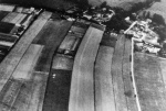
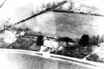
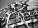
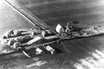
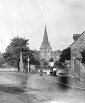
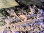
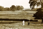
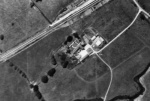
An early aerial photograph showing Strip Field Cultivation at Church Westcote. Each strip was probably a 'furrow long', i.e. a 'furlong'. Date: c.1935
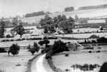
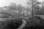
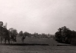
Across the Evenlode Valley. View along the road from Milton under Wychwood towards Lynham. View shows the railway (Cotswold Line), the house on the right would be the crossing keeper's house.
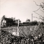
Photograph of John Rawlins (centre) with his parents in the garden at "Sunnyside", Shipton Road, Milton under Wychwood. The trees on the horizon are those on the Shipton to Burford road. This view is no longer visible due to the building of houses, "Charnwood" and "Priors Haven", blocking the view. At the very bottom left of the photograph is a 'well head'. This has now been removed to accommodate a driveway for a car. Date: 1950
Prebendal farm Shipton about 1900
An old postcard of Shipton Probably before 1920s. Shows the old Prebendal farm
Post Card photograph of Shipton Water Mill (to the left of Photo) taken from 'Lower End' Milton Road Shipton under Wychwood. The cottage (nearest on the left) and the Mill House burnt down leaving only "Mill Cottage" (hidden by trees) standing today. (Before electricity installed) Date: late 1920s
Aerial view of Shipton in the late 1920s. A Percy Simms postcard.
Ascott under Wychwood - looking across farm to railway
Milton: Lyneham Road 1910
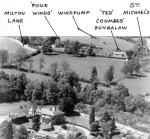
Shipton Lodge to Milton Lane ariel view early 1930s
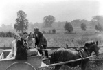
Packer Postcard-Antona Series. Sheep folded under tree, 1930s. Views down and over the land to the West.
Shipton, Swinbrook Road, view North. Couple walking up Swinbrook Road.
Trotts, Chapel Lane early 1900s. Looking NE to two semi-detached cottages. One on right served as Court laundry. Baptist Chapel. Springside to left of the Chapel. Rear of cottages top left, now The Spout.
Station Road Shipton from above the bridge. Undated but probably prior to 1900. Parsonage farm with rick yard and school. St Mary's church but old Beaconsfield hall not visible.
Postcard probably produced by Mike Linfield. View towards the Downs and Leafield Radio Station. Probably 1960s. Sent as a postcard Feb'97. Probably taken from Langley Holdings. Sheep and Masts of Leafield Radio Station and BT College.
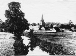
View of Shipton probably from site of Matthews Mill. On postcard posted to Mrs Bliss, The Manor, Chadlington on 31 December 1912. Postcard by Frank Watts of Milton Parsonage Farm with rick yard on right of Tithe Barn. School on right
High Street Milton from Pratley's to London House
Aerial view of Milton Road, Shipton under Wychwood showing houses from L to R: Castle Bank, Wayside, and Four Winds. Date: post WW2
Milton Church Road The Heath 1982
Honeydale Farm between A361 and Ascott. Taken around 1960
Burford Road going up to Shipton Downs about 1930.
View towards Prebendal and Shipton centre from about Matthews mill site. Note the flooded fields . Probably taken in the 1970s
Entrance to Shipton from Station Hill. Simms postcard probably dating from the 1910s posted in Shipton in 1919. No poles apart from GWR telegraph. Dusty and rutted road with chickens in distance
Top of Church Street, marked 1904
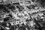
Milton from the air
Jubilee Lane Milton under Wychwood - Calais Field view towards Dog Kennel Lane c.1909
Frog Lane Milton under Wychwood - view from Dog Kennels of Frog Lane
Frog Lane Milton under Wychwood - Calais Cottage 1968
Frog Lane Milton under Wychwood - Burrus family 1930s - view from Ravenswood across Frog lane to the woods around Shipton Court Lanes
Frog Lane Milton - Ariel view
Green Lane Milton under Wychwood. No other information so far discovered
Green Lane Milton under Wychwood - Fishponds in Sandsbrook Field, Lane End Farm. (said to belong at one time to Bruern Abbey)
Ascott under Wychwood - Vicarage drive
Ascott under Wychwood - view of wooden bridge over river on left of Chipping Norton - Ascott road as you descend hill looking towards Chilson (just right of centre)
Ascott under Wychwood - left of Chipping Norton-Ascott road where cattle come down to drink
Ascott under Wychwood - floods- looking up hill of Chipping Norton-Ascott road. Bridge to right of centre (info from Ian Fletcher 11/9/2003) Postcard - possible date from stamp 1923
Ascott under Wychwood - The Bridge - postcard
Ascott under Wychwood - The bridge looking towards village
Ascott under Wychwood. Aerial view - The Manor
The Green - view from the High Street near the Crown (Shaven Crown) Hotel across the allotments (now The Green) towards St Mary's Church Possibly 1950s
Shipton under Wychwood: High Street, view looking north east by The Green. On the right is the Memorial Fountain and the War Memorial. The shop is Dee's Stores (latterly Costcutter
View of the Crown Hotel and the High Street from Church Street and The Green.
View looking north along High Street from Church Street and The Green. Points noted include: a Ford Model T - with solid tyres;Fred Vernalls - telegram delivery boy (in the centre) No electric cables (only telephone cables). A sale/market being held at 'The Crown'. Date: pre 1930
View of The Green and St. Mary's Church, Shipton under Wychwood.Points of note include: the row of cottages across the Green which were demolished soon after the photograph was taken and a wall built around the the whole field. Dee's, Hathaways, Shipton Stores (later 'Costcutter') were subsequently built to the left of the old 'Crown' sign.Date: circa 1900
The Crown and High Street, Shipton under Wychwood, View looking north with Shipton Stores (centre) on the right of High Street. Date: 1920s
High Street by The Crown Inn. View looking north along the High Street where traffic is parked; possibly a stock sale is ongoing on land behind the Crown Inn. Date: c.1930s
Shipton under Wychwood; View looking north along High Street from Church Street and The Green. Points noted include: a Ford Model T - with solid tyres; Fred Vernalls - telegram delivery boy (in the centre) No overhead electric cables (only telephone cables). A sale/market being held at 'The Crown'. Date: pre 1930
Leafield; a village view. Location to be verified, but there appears to be a chapel in the left of the photograph. Date: not known
Here is our ever-expanding Tag Cloud filled with our specific subject keywords.
1850s 1860s 1870s 1880s 1890s 1900s 1910s 1920s 1930s 1940s 1950s 1960s 1970s 1980s 1990s 2000s Activities Animals Ascott Buildings Childhood Church Westcote Churches Farming Groups Interiors Leafield Lyneham Military Milton Names Names.1920s People Pubs Schools Shipton Shops Sports Streets Vehicles Views
