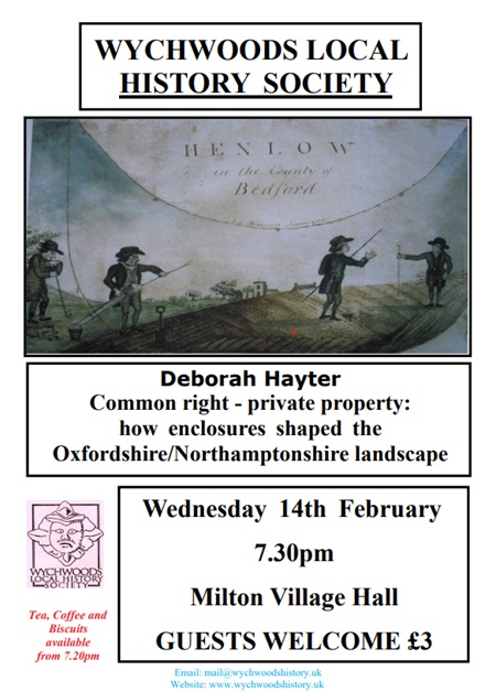
Speaker: Deborah Hayter
Subject: ‘Common right : private property and how enclosures shaped the Oxfordshire/Northamptonshire landscape’
There was a hectic period of enclosure by Parliamentary Act in the late 18th century which drastically changed the surroundings of many local villages which were still farming using the medieval open fields.
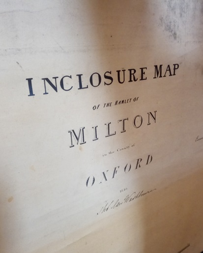
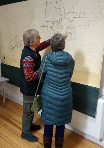
The Enclosure Map in Milton Village Hall
We were pleased to welcome 9 visitors to a gathering of 50+ to hear Deborah’s talk, which attracted some interesting audience questions, as well as a chance to socialise. Members and guests also enjoyed the opportunity to view the Enclosure Map archived in Milton Village Hall.
Definition of Terms
Deborah was able to explain that common land is land owned by the general public and to which everyone has unrestricted right of access. However,all common land is private property, whether the owner is an individual or a corporation. Although generally in the past, the owner of the common could have been for example, the lord of the manor, today many commons are owned by local authorities, the National Trust and other bodies for the public benefit. However not all commons offer total access to all comers.
In detail, common right included the following, although there were others:
- of pasture: the right to graze livestock; the animals permitted, whether sheep, horses, cattle and such, were specified in each case.
- of estovers: the right to cut and take wood (but not timber), reeds, heather, bracken and the like.
- of turbary: the right to dig turf or peat for fuel.
- in the soil: the right to take sand, gravel, stone, coal and other minerals.
- of piscary: the right to take fish from ponds, streams and so on.
These rights related to natural produce, not to crops or commercial exploitation of the land.
Common Land Over Time
In her talk, Deborah demonstrated how the landscape changed over the course of 300 years. She showed the contrast in the total area of common land over time. In the late 17th century, perhaps 25-30% of the land in England was Common (or 8-9 million acres). By the mid-20th century only 4000 commons were recorded. These had an acreage of 1 – 1.3 million acres, much of which is to be found in Scotland and Wales, and the English North West.
We learned some of the key reasons over time which drove these massive changes. We started in the Middle Ages, when benign 12th century weather patterns morphed into harsher climate conditions in the next 100 years. This was a time which also included the massive depopulation of the country due to the Black Death, which caused de facto changes in land use as villages depopulated or disappeared altogether.
Open Field System
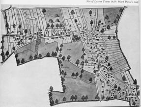
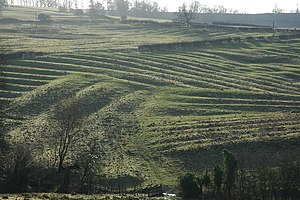
The open field system grew from these changes, through which common right became established. An example of the open field system still extant today is at Laxton in Nottinghamshire, but we do also see in the landscape in parts of the country, the visible signs of that system in the ridge-and-furrow in fields which have seen little of the plough.
Towards the Parliamentary Enclosure Act
Enclosure thus was not always problematic. On the whole, agreements between land owners and a parish about enclosure were not by any means acrimonious, and in the 16th and 17th centuries we can find documents in the Chancery which show positive and settled working agreements.
But we learned that by the 18th century changes in agricultural practices – as improved crop rotation, additional land requirements for growing populations, and improved drainage systems, all conspired to create a drive to top-down efficiencies and so a commensurate diminution of common rights.
A key event was the ‘Inclosure Consolidation Act’ of 1801 which really spelt massive compromises to common rights. Much parliamentary enclosure took place throughout the first half of the 19th century, and so for example counties such as Oxfordshire found themselves at an epicentre of enclosing activity. Curtailment of rights and rural depopulation became watchwords.
Deborah took us though examples and exceptions to this general flow of history, with many maps and illustrations around field and road definitions which gave insights into the reasons for the look our landscapes today.
Included in her examples was the eventual loss of much of the Wychwood Forest, and intriguingly, the fact that Milton (1848) and Shipton (1852) came late in the cycle of enclosure activity. Why so late? she asked. Why indeed, Historians!
About Deborah Hayter
Deborah has an MA from Leicester University’s Department of English Local History, and has been teaching Local and Landscape History in Oxford University’s Department of Continuing Education for some 20 years.
She is first and foremost a landscape historian, looking to answer the question ‘Why do places look like they do?’, but she has also taught courses on village history and on the history of poor relief, which is a particular interest.