by Ian Sanders
The society recently heard from Shipton resident Ian Sanders with some intriguing insights into landscape changes near his home. The recent snowfall had a story to tell. Here is Ian’s summary.
Julia and I moved to Shipton at the end of 2019, and live at Littlestock, which is the last house on Meadow Lane just over the bridge over the Littlestock Brook. With the property, we acquired the meadow which stretches all the way down to the Evenlode. It has Shipton Mill the other side, and the Littlestock Brook running along the southern border in roughly a straight line. As to the house – there are no proper deeds, and the estate agent vaguely said it dated back to around 1800.

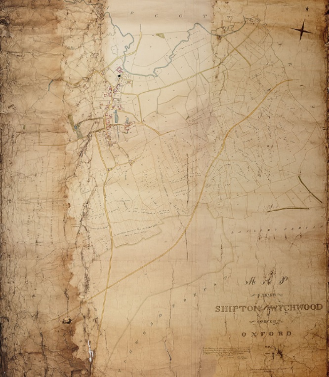
A couple of months back we were sent this link to the old pre-enclosures tithe map for Shipton village dated to 1830.
( Please click the link for the fully scaleable map, which gives all the detail for what follows.)
© Oxfordshire History Society
The first thing I looked for was our house – and the map shows that Meadow Lane and all the houses along it did not exist at that time.
Secondly, the brook wanders all over what were presumably water-meadows, making it difficult to place exactly where our house was later positioned. The Evenlode was also taking a very different course as it flowed down to Shipton bridge from the north-west.

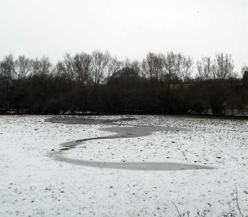
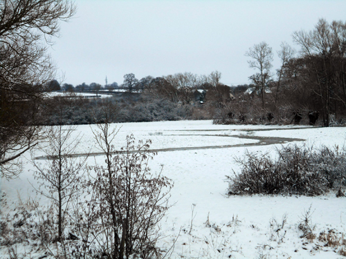
On Sunday 24th January the snow came, transforming the landscape, and what was clearly shown was a watercourse running across the field to the left of the Evenlode as you look northwards from the bridge. If one then compares this to the 1830 map, one can see that the river did not run straight to the bridge as it now does, but meandered across where this field now in very much the same pattern as this watercourse now does. If this watercourse is in fact the old course of the river, then it confirms the accuracy of the old 1830 map.

The next thing I thought about was what the map tells us about the original channel of the Littlestock Brook. Within our meadow are what I thought were natural oxbows which fill up with water for much of the winter, and these again showed up well in the snow rather like a serpent musical instrument. I originally thought they could have been the course of the Evenlode. If the 1830 map is to be believed, this was the Littlestock Brook as it took a course northwards before joining the Evenlode, roughly at the north-east corner of our meadow below the Shipton Mill.
As to our house and Meadow Lane, I presume that these were built post enclosures in the 1850’s, and following the straightening of the courses of the Littlestock Brook and the Evenlode as it approached Shipton Bridge. Up until then this part of the village may have flooded too often to be built on, and 150 years on is again becoming a frequent event!


Interesting to see this. We walked through this field recently after heavy rain and could see the path of the stream.